


Aloe Trail
Location
Eastern Cape > Gqeberha > Blue Water Bay
Eastern Cape > Gqeberha > Blue Water Bay
Add to travel planner
Description
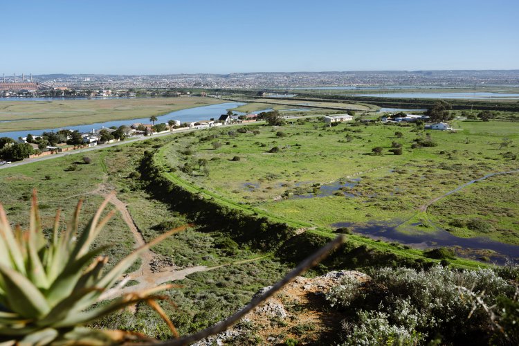
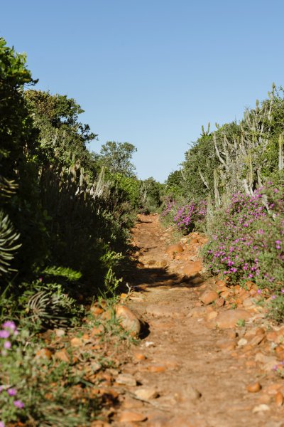
The Aloe trail comprises two trails: one of 2 km, marked with yellow arrows, and a longer one of 7 km (3 hours), marked with red arrows. Both start at a gate at the top of Tippers Creek Road, between Amsterdamhoek and Bluewater Bay. The trail takes a circular route via the escarpment overlooking Amsterdamhoek, returning through valley bushveld on the plateau. Amsterdamhoek is named after a Dutch man-of–war, the Amsterdam, which ran aground near the mouth of the Swartkops River on 16 December 1817. The walks are suitable for reasonably fit persons, who are advised to walk in a group, wear stout shoes and take a sunhat and drinking water. NO DOGS are allowed.
The Aloe trail comprises of two trails one of 2 km marked with yellow arrows and a longer one of 7 km (3 hours) marked with red arrows. Both start at a gate at the top of Tippers Creek Road between Amsterdamhoek and Bluewater Bay. The trail takes a circular route via the escarpment overlooking Amsterdamhoek returning through valley bushveld on the plateau.
Amsterdamhoek is named after a Dutch man-of –war, the Amsterdam, which ran aground near the mouth of the river on 16 December 1817. The walks are suitable for reasonably fit persons, who are advised to walk in a group, w ear stout shoes and take a sunhat and drinking-water.
NO DOGS are allowed.
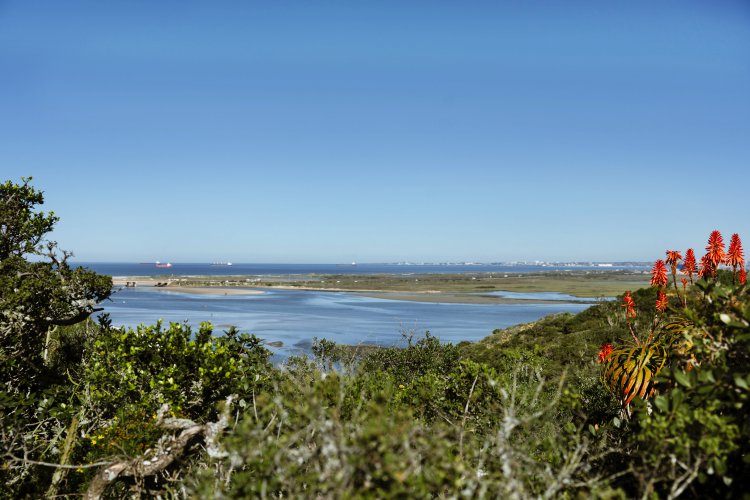
The dense, stunted vegetation known as valley bushveld seen along the trail has adapted to the arid climate combined with the shallow clay soils on top of calcareous sandstone. Aloes, especially A. pluridens, at the start of the trail make a stunning show when in flower during June/July and attract many sunbirds.
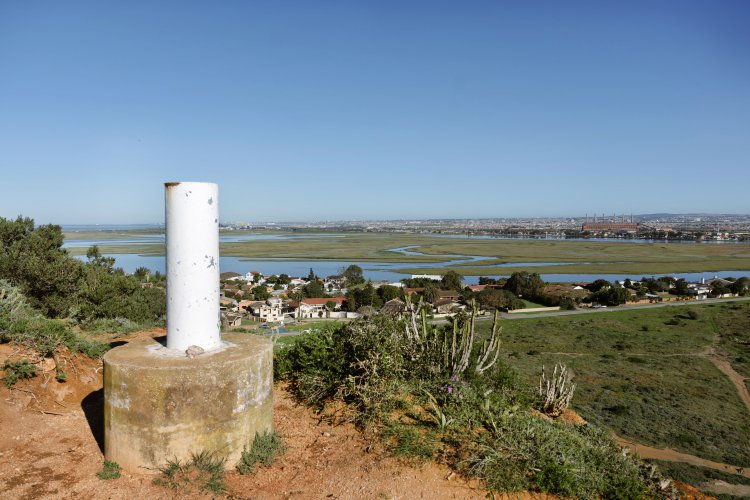
Views from the top of the escarpment are excellent w here the lower reaches of the Zwartkops estuary, a major recreational area can be seen. Estuaries are amongst the most productive ecosystems on earth w here salt marsh vegetation provides food for mud prawn and other invertebrates living in the intertidal mudbanks, these animals in turn provide a food source for birds and fish. There is also a good view upstream to Redhouse, the Zwartkops Nature Reserve, saltpan and beyond to Uitenhage and Cockscomb, the source of the river.
The trail in places follow s old game-tracks worn down several centimetres below the level of the surrounding ground, over the centuries, by the passing animals. Note how the removal of the valley bushveld binding the clay slopes caused widespread erosion and also how the vegetation has adapted to withstand the dry conditions, different species storing water in leaves, stems or underground bulbs.
Other plants have tough, leathery leaves that do not lose much moisture, and many have thorns to protect them from grazing animals. Grysbok are common, whereas bushpig and the rare blue duiker are seldom seen. Formerly this bush supported many game animals, including elephant. The only remaining evidence of the presence of these large mammals is well-worn game tracks and the old wallows. The trail passes through a series of these wallows which can be seen as bush-free depressions that hold water after good rains.
Click Here To Download the Aloe Trail Hiking Trail Map
NOTE: USE OF THE AREA IS ENTIRELY AT YOUR OWN RISK
Amsterdamhoek is named after a Dutch man-of –war, the Amsterdam, which ran aground near the mouth of the river on 16 December 1817. The walks are suitable for reasonably fit persons, who are advised to walk in a group, w ear stout shoes and take a sunhat and drinking-water.
NO DOGS are allowed.
The dense, stunted vegetation known as valley bushveld seen along the trail has adapted to the arid climate combined with the shallow clay soils on top of calcareous sandstone. Aloes, especially A. pluridens, at the start of the trail make a stunning show when in flower during June/July and attract many sunbirds.
Views from the top of the escarpment are excellent w here the lower reaches of the Zwartkops estuary, a major recreational area can be seen. Estuaries are amongst the most productive ecosystems on earth w here salt marsh vegetation provides food for mud prawn and other invertebrates living in the intertidal mudbanks, these animals in turn provide a food source for birds and fish. There is also a good view upstream to Redhouse, the Zwartkops Nature Reserve, saltpan and beyond to Uitenhage and Cockscomb, the source of the river.
The trail in places follow s old game-tracks worn down several centimetres below the level of the surrounding ground, over the centuries, by the passing animals. Note how the removal of the valley bushveld binding the clay slopes caused widespread erosion and also how the vegetation has adapted to withstand the dry conditions, different species storing water in leaves, stems or underground bulbs.
Other plants have tough, leathery leaves that do not lose much moisture, and many have thorns to protect them from grazing animals. Grysbok are common, whereas bushpig and the rare blue duiker are seldom seen. Formerly this bush supported many game animals, including elephant. The only remaining evidence of the presence of these large mammals is well-worn game tracks and the old wallows. The trail passes through a series of these wallows which can be seen as bush-free depressions that hold water after good rains.
Click Here To Download the Aloe Trail Hiking Trail Map
NOTE: USE OF THE AREA IS ENTIRELY AT YOUR OWN RISK
MAP
Latitude : -33° 51' 10.99" S | Longitude : 25° 37' 22.10" E
Experiences
Image Gallery
Experience
Things to See and Do
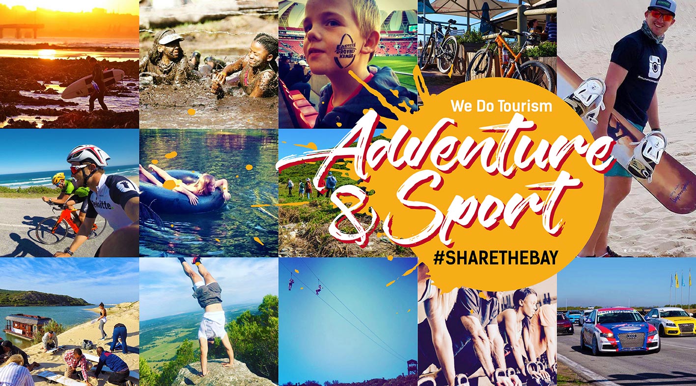
Adventure & Sports
Green Flag Trails
Hiking
Hiking Trails
Wildlife Walks
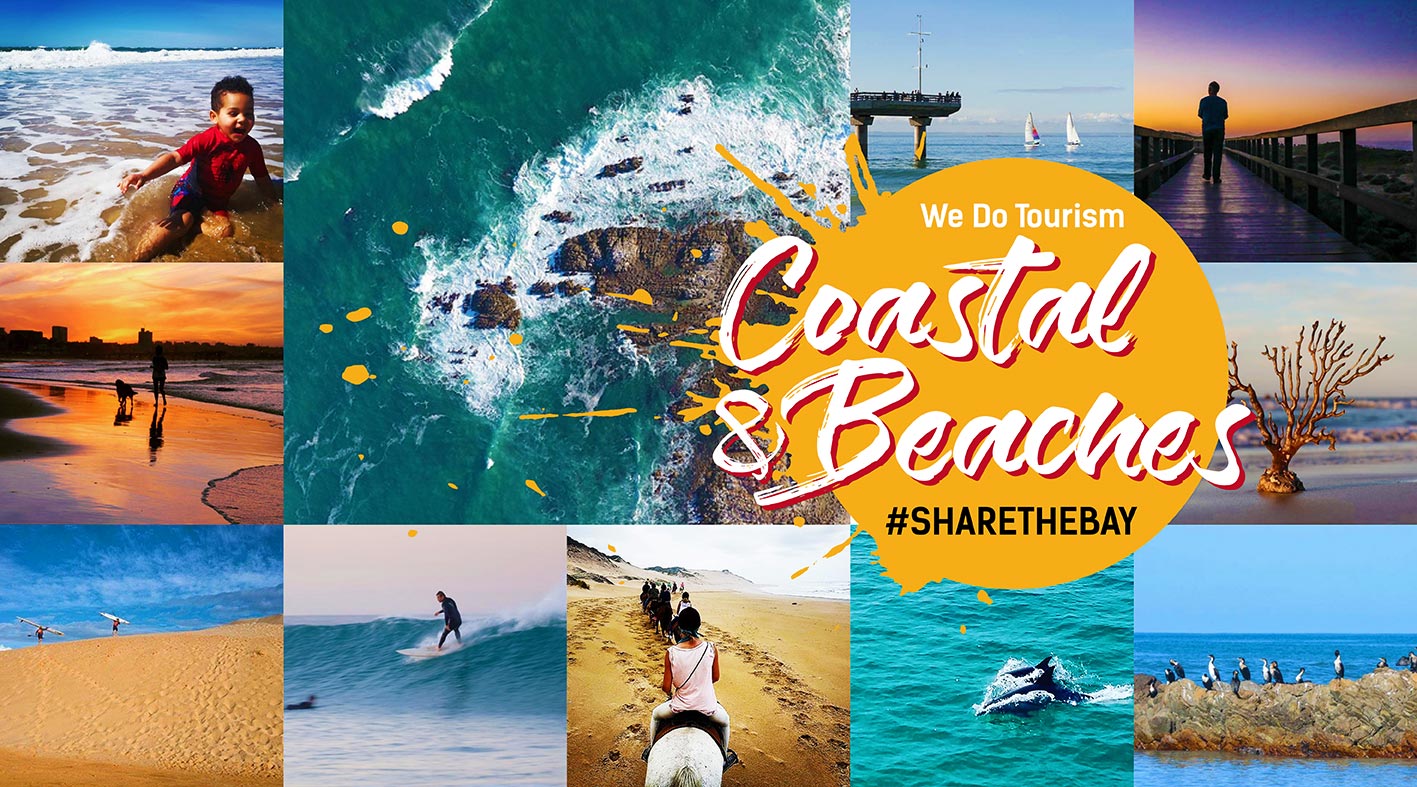
Coastal & Beaches
Hiking Trails
Picnic
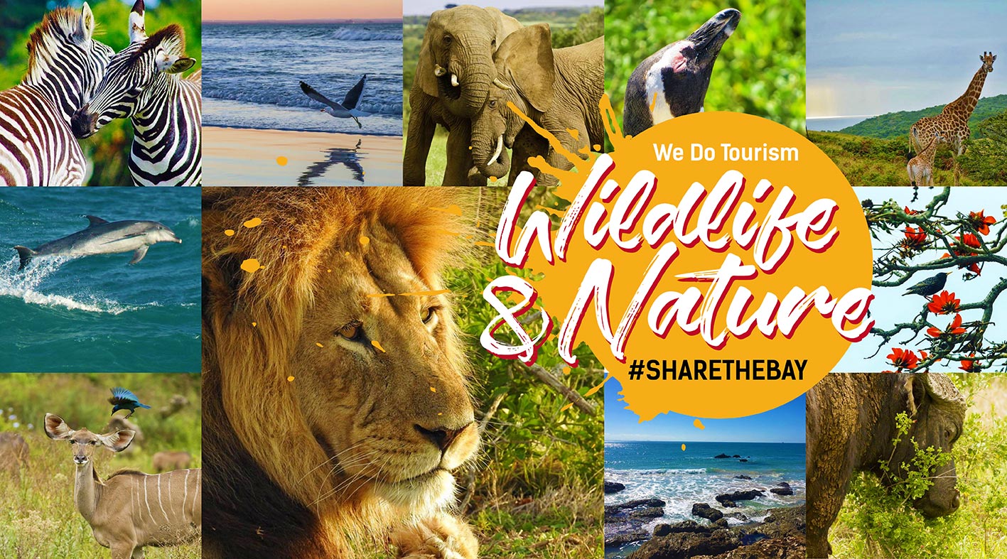
Wildlife & Nature
Bird Watching
Green Flag Trails
Hiking Trails
Natural Heritage
Unique Biom
View Site
Wilderness Trails
Wildlife


 Please wait!