


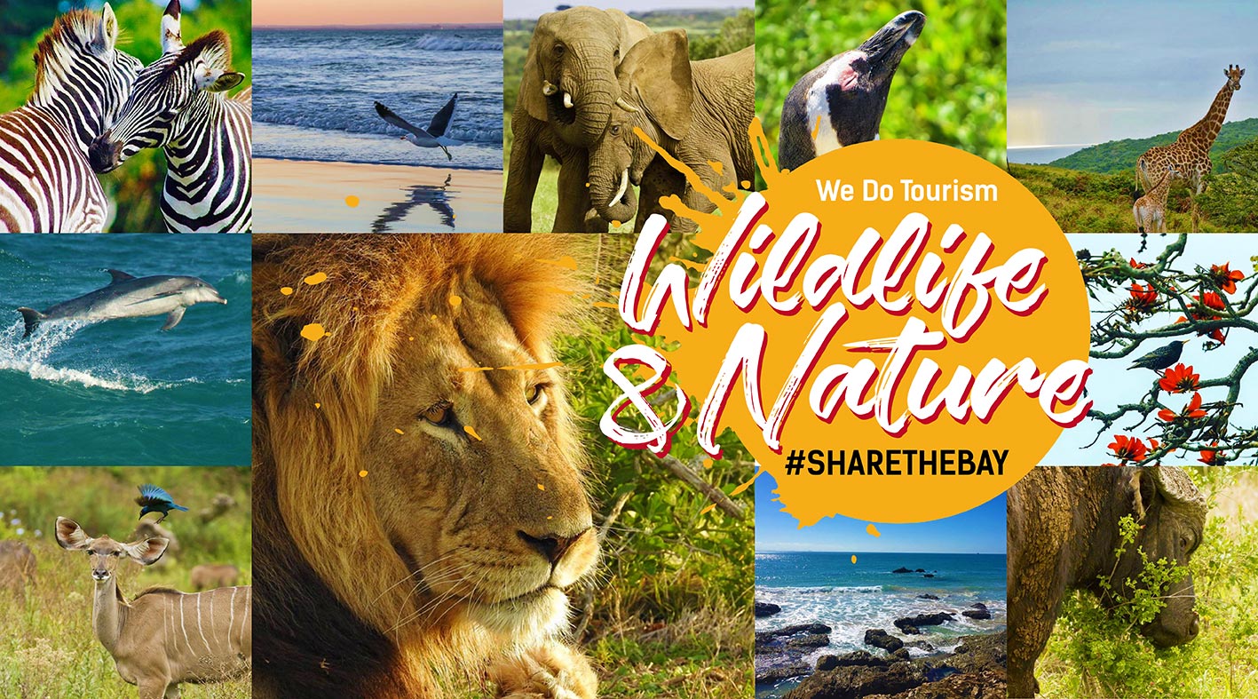

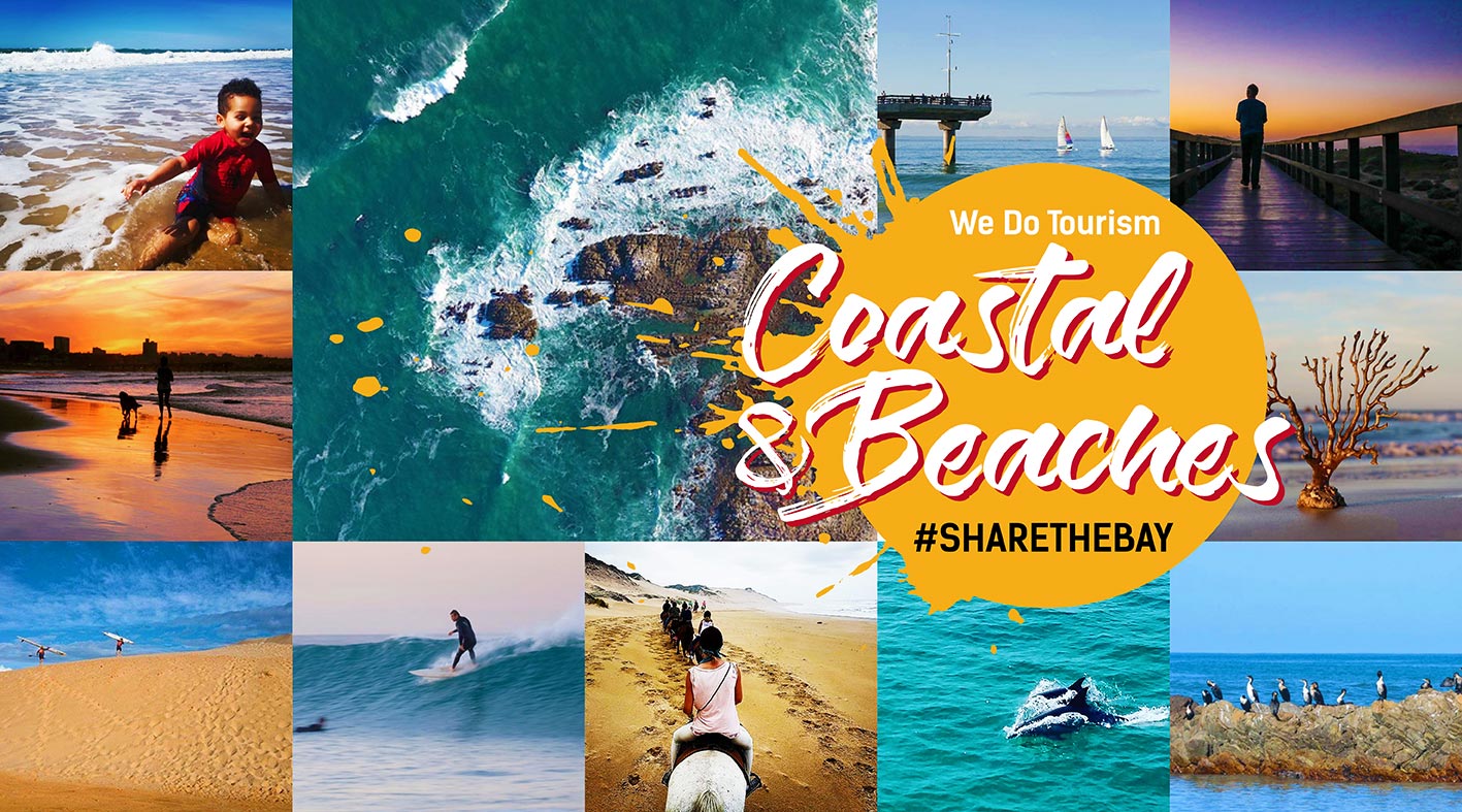
Searching Things to See and Do
Search Location :
Displaying result 1 - 10 of 20
Coastal Fynbos Trail
Location : Eastern Cape > Gqeberha > Schoenmakerskop
HISTORY AND LOCATION
An inland route is followed through the coastal fynbos starting and returning to Sappershoek along the top of the ridge overlooking the sea. In 1962/3, “Sappershoek” was erected to house retired servicemen.
The area forms part of the Cape Floral Kingdom and is one...
Lady's Slipper Adventure Centre
Location : Eastern Cape > Gqeberha > Van Stadens
LADY’S SLIPPER TRAIL: 5.2 KM (4.6 KM RED TRAIL)
TRAIL TYPE: LINEAR/CIRCULAR (UP RED TRAIL)
DURATION: 2/3 HOURS
DIFFICULTY: EASY/MODERATE
RECOMMENDED HIKING TIMES: 08h00 – 16h00 (gate closes at 16H00)
Winding through the forests, from Falcon Rock to the “Lady’s Slipper”...
Van Stadens Wild Flower Reserve
Location : Eastern Cape > Gqeberha > Van Stadens
VAN STADENS WILDFLOWER RESERVE TRAILS: (FROM 0.5 - 7.5 KM)
TRAIL TYPE: LINEAR/CIRCULAR (UP RED TRAIL)
DURATION: 2/3 HOURS
DIFFICULTY: EASY/MODERATE
RECOMMENDED HIKING TIMES: 07h30 – 16h30 (gate closes at 16H30)
A breath taking floral wonderland where nature’s artistry is fully...
Bushbuck Trail
Location : Eastern Cape > Gqeberha > Seaview
The Island Nature Reserve offers numerous walks, the most well known being the 16km Bushbuck Hiking Trail which starts just outside the Main Office of the Island Nature Reserve. The Bushbuck trail can also be fragmented into 5 different trails according to the distance they are covering.
Grootkloof Environmental Centre and Hiking Trail
Location : Eastern Cape > Gqeberha > Bethelsdorp
GROOTKLOOF HIKING TRAIL
TRAIL TYPE: CIRCULAR
DURATION: 1/2 HOUR
DIFFICULTY: EASY
RECOMMENDED HIKING TIMES: 08H00 - 16H30
The Grootkloof Reserve and Educational Centre is located in the suburb of Hillside. The Grootkloof reserve opened in 2015 and is seen as a gateway to Van der Kemp's...
Sacramento Trail
Location : Eastern Cape > Gqeberha > Schoenmakerskop
SACRAMENTO TRAIL: (7.9 KM)
TRAIL TYPE: CIRCULAR
DURATION: 3 TO 4 HOURS
DIFFICULTY: EASY
RECOMMENDED HIKING TIMES: 08h00 – 17h30
Offering phenomenal panoramic views, lush greenery, and a tranquil ambience, this magnificent Trail promises an unforgettable journey filled with history....
Settlers Park Nature Reserve
Location : Eastern Cape > Gqeberha > Central
The 54-hectare tranquil Settler's Park, which lies along the banks of the Baakens River, is located in the heart of the city.
Grass Roof Restaurant, Farmstall and Bakery
Location : Eastern Cape > Gqeberha > Lovemore Park
Grass Roof Restaurant, Farmstall, and Bakery, located in Port Elizabeth, offers a unique culinary experience blending farm-fresh ingredients with artisanal techniques. At the restaurant, patrons can indulge in delectable dishes made from locally sourced produce, ranging from hearty breakfast...
Rheta’s Trail
Location : Eastern Cape > Gqeberha > Schoenmakerskop
Retha’s Trail is a whimsical and heartwarming walking path tucked away in the coastal village of Schoenmakerskop, just outside Gqeberha (Port Elizabeth), South Africa. This enchanting trail offers a one-of-a-kind outdoor experience where creativity, community spirit, and coastal charm come...
Island Nature Reserve
Location : Eastern Cape > Gqeberha > Seaview
The Island Nature Reserve is located approximately 25 km from Port Elizabeth and is accessed via the Seaview Road turn off along the national road. The Reserve comprises 480 ha of indigenous Alexandria coastal forest and boasts tree species such as Outeniqua yellow-wood, white and hard pear as...


 Please wait!